The Convention Centre
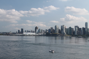 The ‘Sails’ was the original Vancouver Convention Centre, built for Expo ’86 and designed to look like the prow and sails of a large ship when viewed from the water. At one point there was a restaurant in the glassed-in building that makes up the prow that was called (predictably) The Prow Restaurant. Great view and very high end. It’s gone now, and Vancouver has outgrown the convention space available in the Sails, so a second (green) convention center was built beside the original. It’s the low, brown building to the right of the Sails in this picture. If you look closely you will see that the building has a grass roof – but no goats!
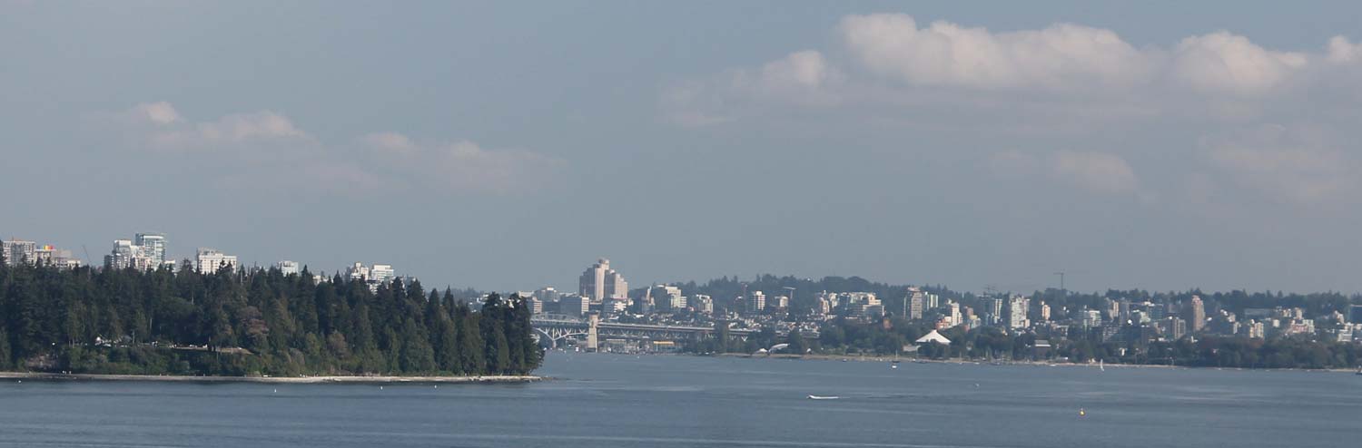
 The North Shore
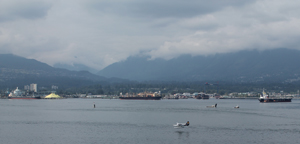
Vancouver’s harbour is mainly on the south side of the Burrard Inlet, but there is also considerable activity on the North Shore as well. The city and district of North Vancouver climbs up the slopes of the North Shore mountains, with the sea level area being mainly commercial or industrial use and housing being on the slopes of the mountains. The main North Shore mountains are Cypress (in West Vancouver, beyond the Lion’s Gate Bridge) which overlooks English Bay; Grouse, in the city of North Vancouver (home of the Grouse Grind), and Seymour, in the district of North Van. Vancouverites cross country and downhill ski on all three mountains in the winter and hike there in the summer. Shrouded in clouds and looming ominously over the city, or thrusting massive and green under a bright blue sky, the North Shore mountains are an ever changing presence for all of Vancouver.
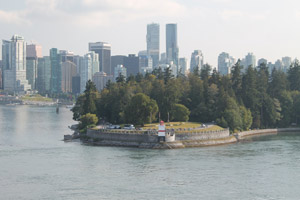 Stanley Park and the Sea Wall
Downtown Vancouver is a combination of commercial hub and high-density residential area. Called the West End, this is a vibrant area and includes high rise apartments and the trendy Robson Street, where high-end shops mix with hotels and niche restaurants. The West End borders on Stanley Park, a large green space that is a combination of dense forests, shot through with walking paths, and groomed spaces. In the photo, the round groomed point thrusting out into the harbour is Brockton Point. The red and white structure in the forefront is the Brockton Point lighthouse. You can also see the Sea Wall, a path that circumnavigates the whole park. It’s a favourite of visitors to Stanley Park, regardless of whether you want to walk, jog or just pause to take pictures.
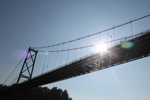 The Lion’s Gate Bridge
Stanley Park is set on a point that makes one side of the First Narrows – the passage that leads from English Bay and the open ocean into the Burrard Inlet and Vancouver’s sheltered harbour. The North Shore side of the Narrows is the point where the cities of West Vancouver and North Vancouver meet. The span between the North Shore and Stanley Park is crossed by the Lion’s Gate Bridge, as iconic to Vancouver as the Golden Gate is to San Francisco. The Lion’s Gate is a three lane bridge – which ever direction has the most traffic gets the extra lane. On the North Shore side traffic from both West and North Vancouver meet for the bridge. Four lanes must merge into two or even one lane. The process is surprisingly orderly with drivers taking turns from one lane and then the next, as four lanes of cars braid into one orderly strand of traffic.
 Fairview Slopes
Downtown Vancouver, the West End and Stanley Park are located on a peninsula that is bordered on the north by the Burrard Inlet and on the south by False Creek, which opens up into English Bay. Three bridges cross False Creek, connecting Vancouver’s west side to downtown. The most westerly is the Burrard Street Bridge, an imposing Art Deco style structure that was built in the 1930s. The mixed commercial and residential areas that hug the shore and climb up the steep incline to the ridge the is the backbone of the West Side and Point Grey include Kitsilano and the Fairview Slopes, where Quinn goes to a meeting about a murder in the upcoming 9 Lives book, Cat Got Your Tongue.
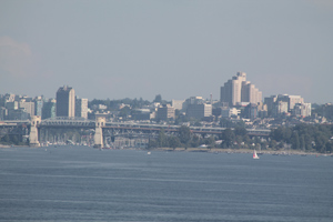
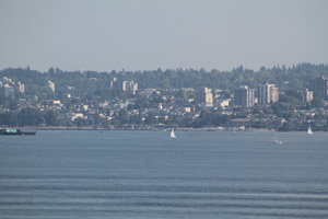 The West Side
The City of Vancouver is U shaped, with the center of the U being English Bay. The downtown, West End and Stanley Park make up the north side of the U. A little squiggle at the base of the U is the False Creek area. The south side of the U is includes the residential areas of Kitsilano, Kerrisdale and Point Grey, all highly desirable parts of Vancouver to live in. The land rises up steeply into a ridge from the beaches line English Bay (Jericho, Lugano and Spanish Banks). Vancouverites love their outdoor activities, so the beaches are always busy and it is never a surprise to see sailboats and other craft out on the water.